


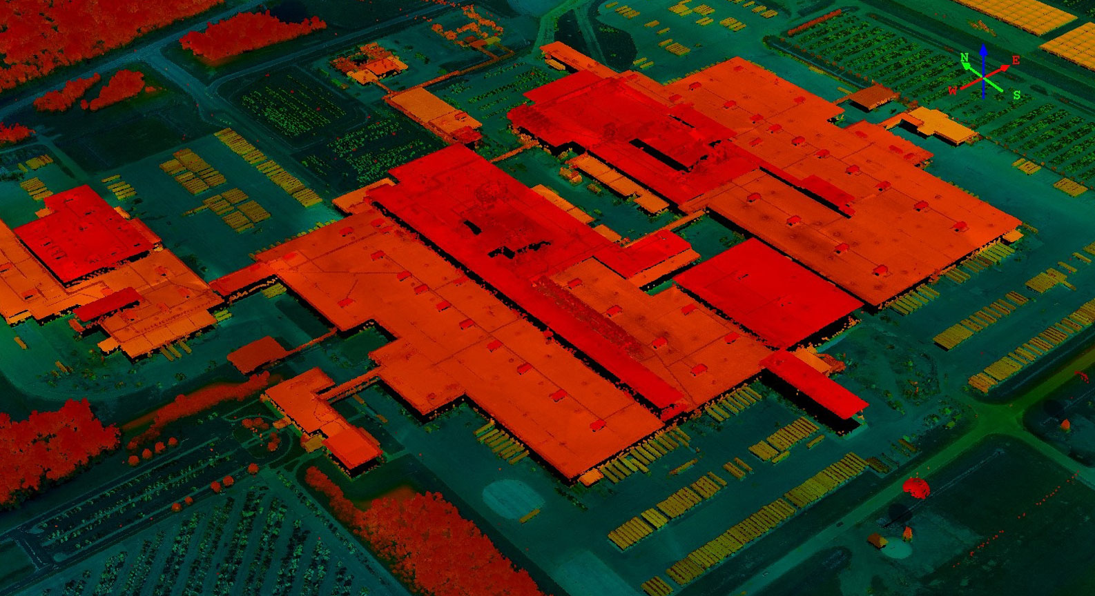
Aerial LiDAR

We are ready to help you out on your Aerial LiDAR data processing. We have very experienced team who has several years of experience in processing and handling point cloud data. We always honor our quality and the deadline.
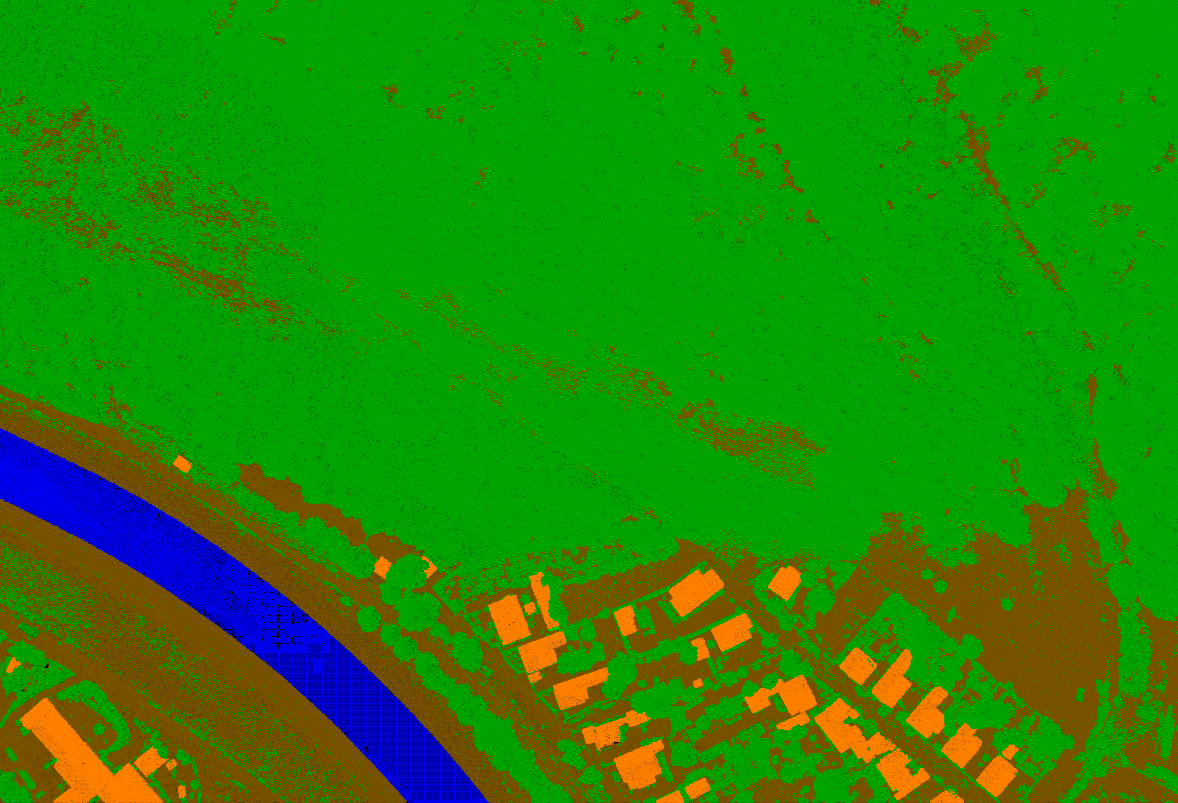
For classification or feature extraction from Aerial LiDAR data, we use Orthophoto, Intensity values of point cloud and google earth images/ street view (where it is possible) as references.
Feature Extraction:
Bare Earth Classification.
Vegetation, Manmade features and Natural features identification and classification.
DTM, DSM, Contour, TIN generation and output in desired format.
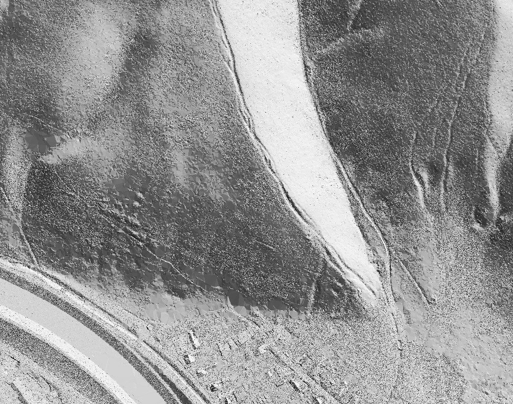
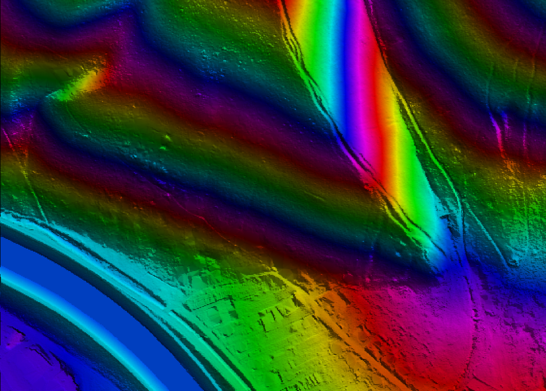
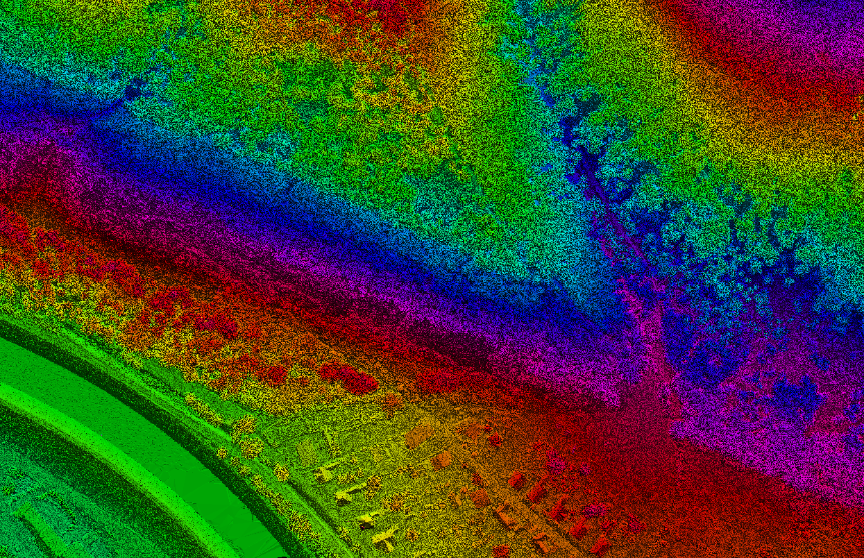
Hillshade image, Intensity image, Heat map etc. preparation.
Hydroflattened DEM/DTM generation.
Slope map, Relative relief map, Drainage map with drainage order etc. preparation and generation.
Landuse & Landcover map.
Identification of encroachment for any corridor projects.
Volume estimation and Change detection.
Orthophoto rectification.
Vectorization of features and preparation of map in desirable format (GIS database/CAD)
Clearance measurement and identification of danger objects for utility line.
New alignment or alternative alignment (Road/Rail) study and preparation.
Terrain modeling with textures and visualization.
Sectors:
Utilities & Energy
Mining industry
Archeology and Architecture
Forestry and Agriculture
Water resources and Horticulture
Government & Taxation
Defense & Military
DTM
Digital Terrain Model created from aerial LiDAR data with best possible accuracy.....
Hydro-Flattened DTM
Hydro flattened DTM is prepared to estimate the actual water level in a river or water body.....

Contour
Contour is another digital representation and modelling of terrain.....
DSM
DSM is created from any first return of point cloud which estimates the volume properly.....
Feature Extraction
All the points from point cloud are segregated accurately to their respective classes.....
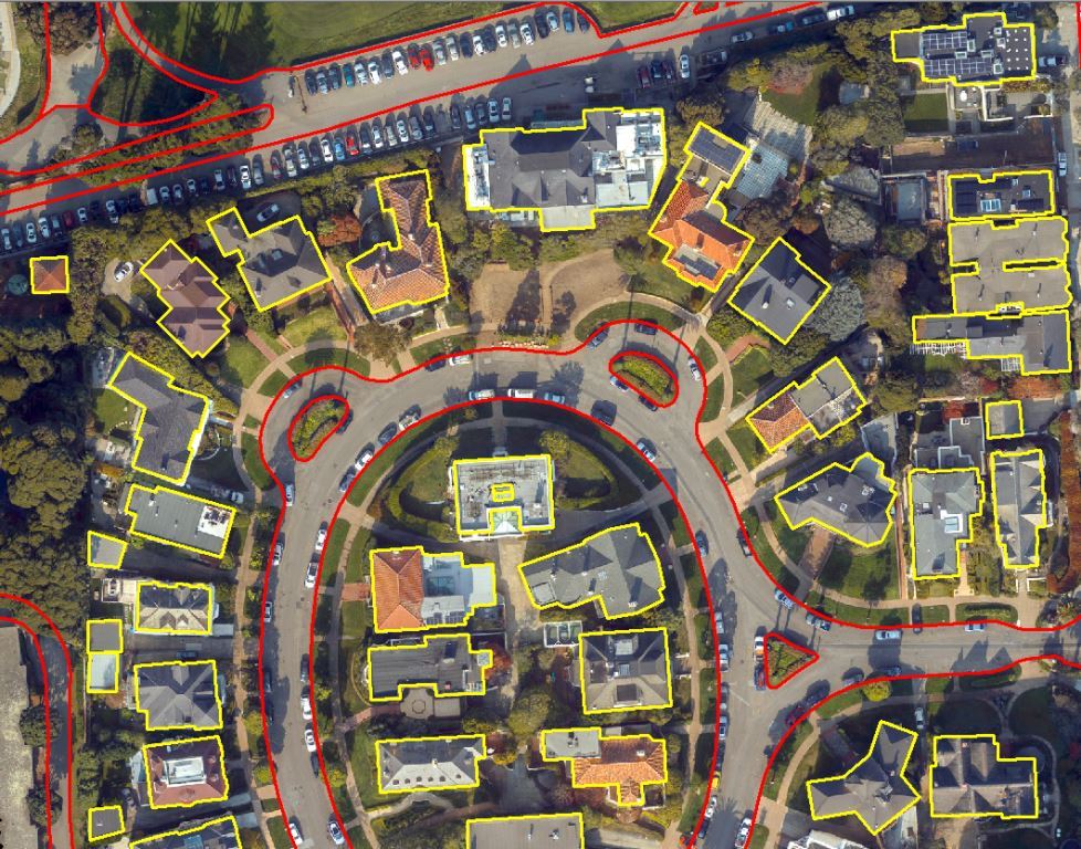
Vectorization
Features are vectorized very carefully and accurately as per the specification.....